By: Andy Wood
The biodiverse Southeastern North Carolina region is a place that supports 1,500 different plant species, arranged in a diverse array of natural habitats, but more than 70% of those habitats are now lost, mostly due to human land alteration for roads, buildings, farming, and other uses.
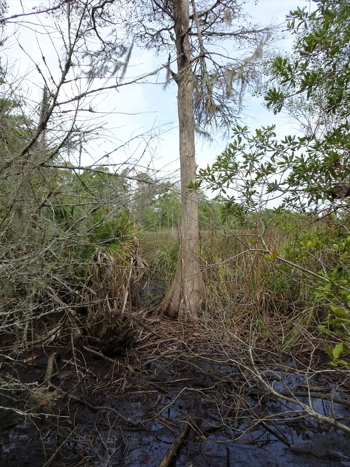
It’s no secret this ecoregion’s land surface is also shrinking as an ever-warming ocean expands its reach inland. And nowhere is this fact more poignant than in NENHC’s Howe Creek Conservation Area (HCCA), where small streams carry clear, fresh water into a headwater swamp where towering loblolly pines and baldcypress grow trunk to trunk, and their lofty branches shelter a diverse array of shrubs, vines, and other plants from sun and wind—but not the inexorably expanding ocean.
It’s inevitable that Howe Creek’s swamp forest will succumb to salty water and, for ecological reasons, that makes it more imperative to protect upstream forest habitat for downstream plants and wildlife to shift-into as their once freshwater home drowns in saltwater. Howe Creek is a microcosm example of what our ecoregion is experiencing at macroscale. Think dead cypress trees in the land-water interface areas fringing the lower Cape Fear and Northeast Cape Fear Rivers. These sentinel skeletons provide testimony to our region’s fate.
The dire tone of my opening aside, this note is intended to share some observations made during a recent monitoring survey in Howe Creek, conducted as part of the Conservancy’s work to keep tabs on what’s happening in (and around) their properties. The observations provide some of the inspiration for this note’s opening remarks.
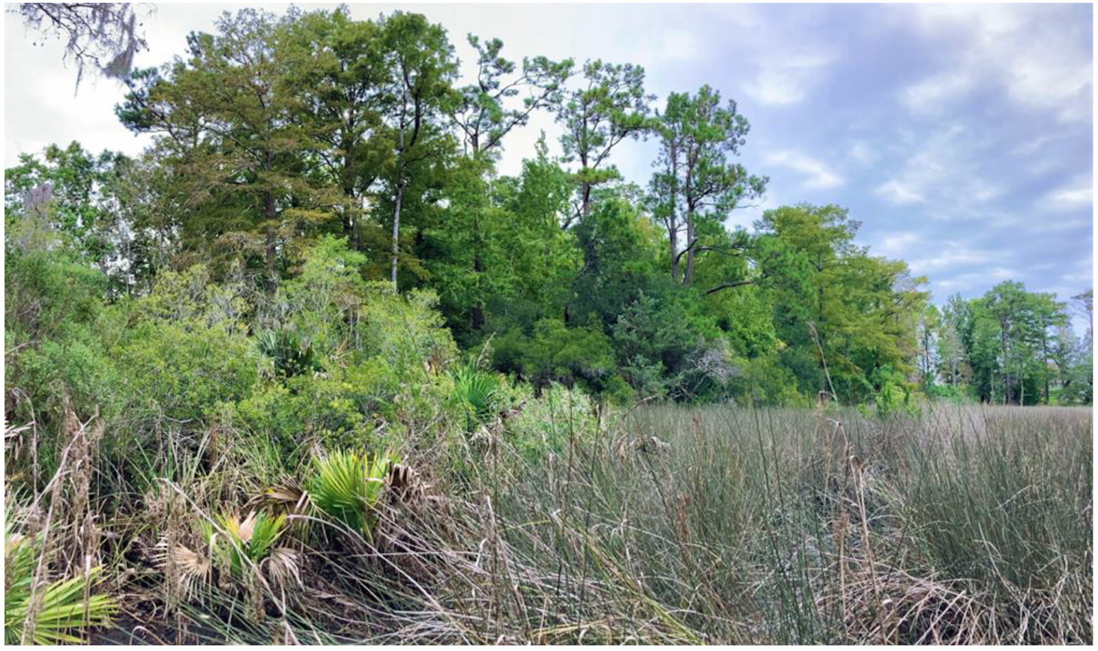
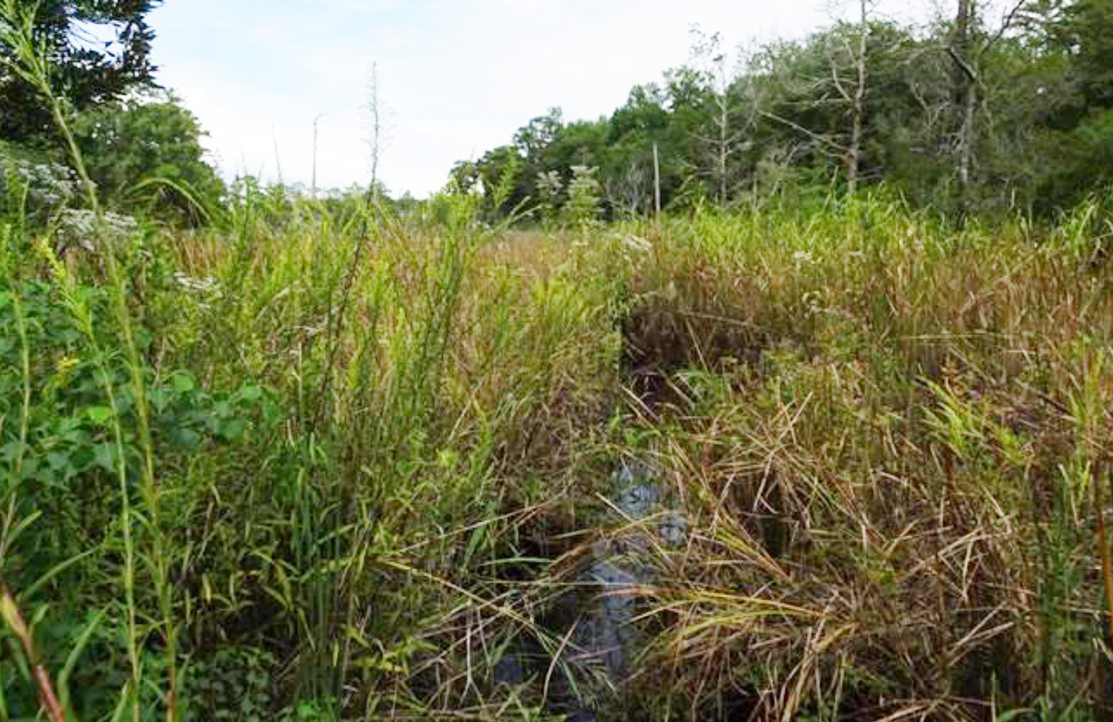
On the day of my visit, the weather hinted at autumn, partly overcast with a light northeast breeze and air temperature less than 90. Maybe not truly autumnal, but after weeks in the upper 90s, it was a welcome change, especially considering access to Conservancy properties is done by foot and getting to the Howe Creek destination meant trekking along the muddy interface of tidal marsh and slightly higher ground, grown over with shrubby yaupon, live oak, and red cedar.
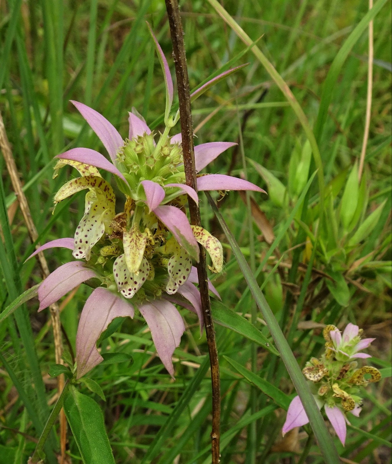
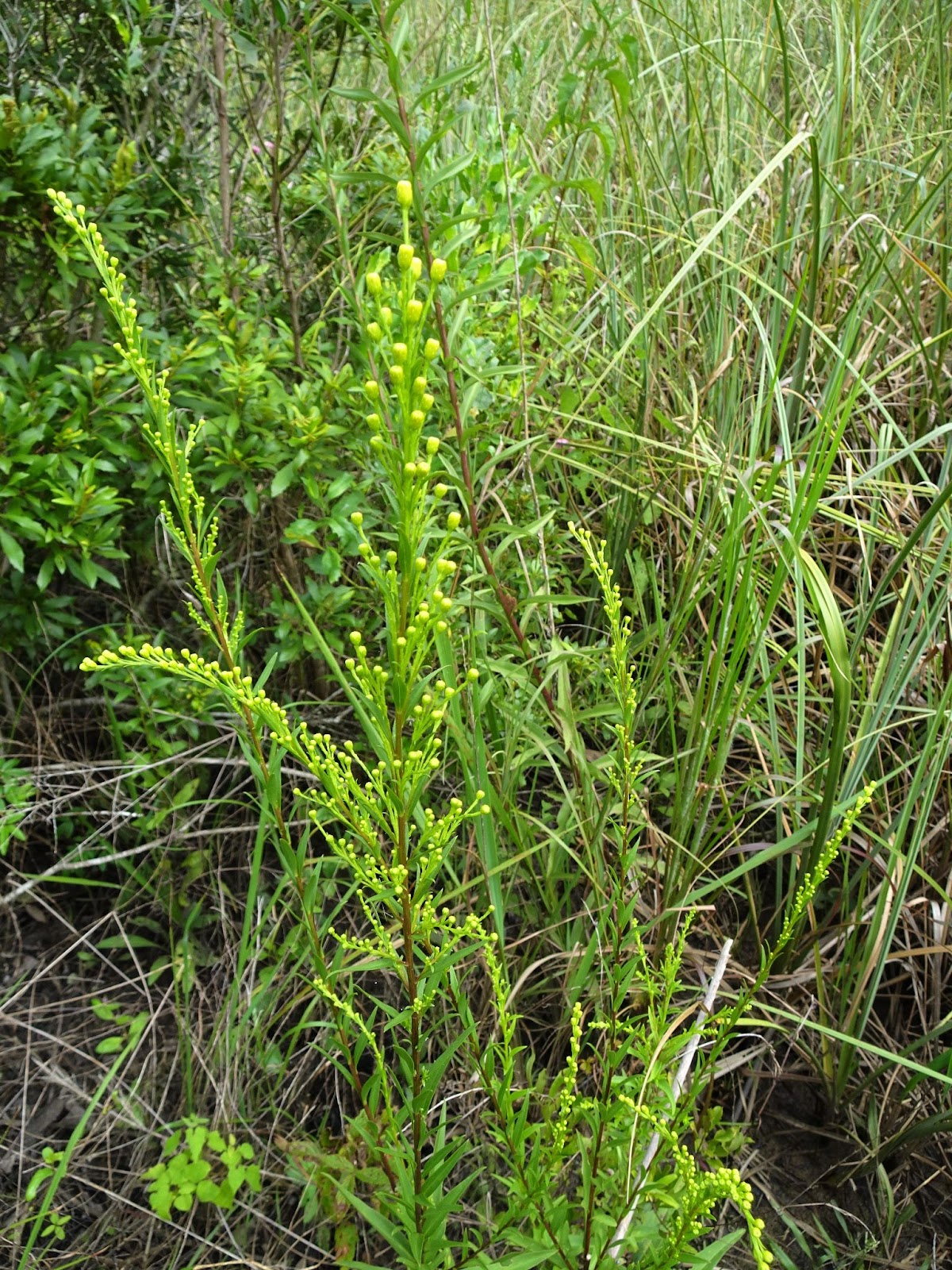
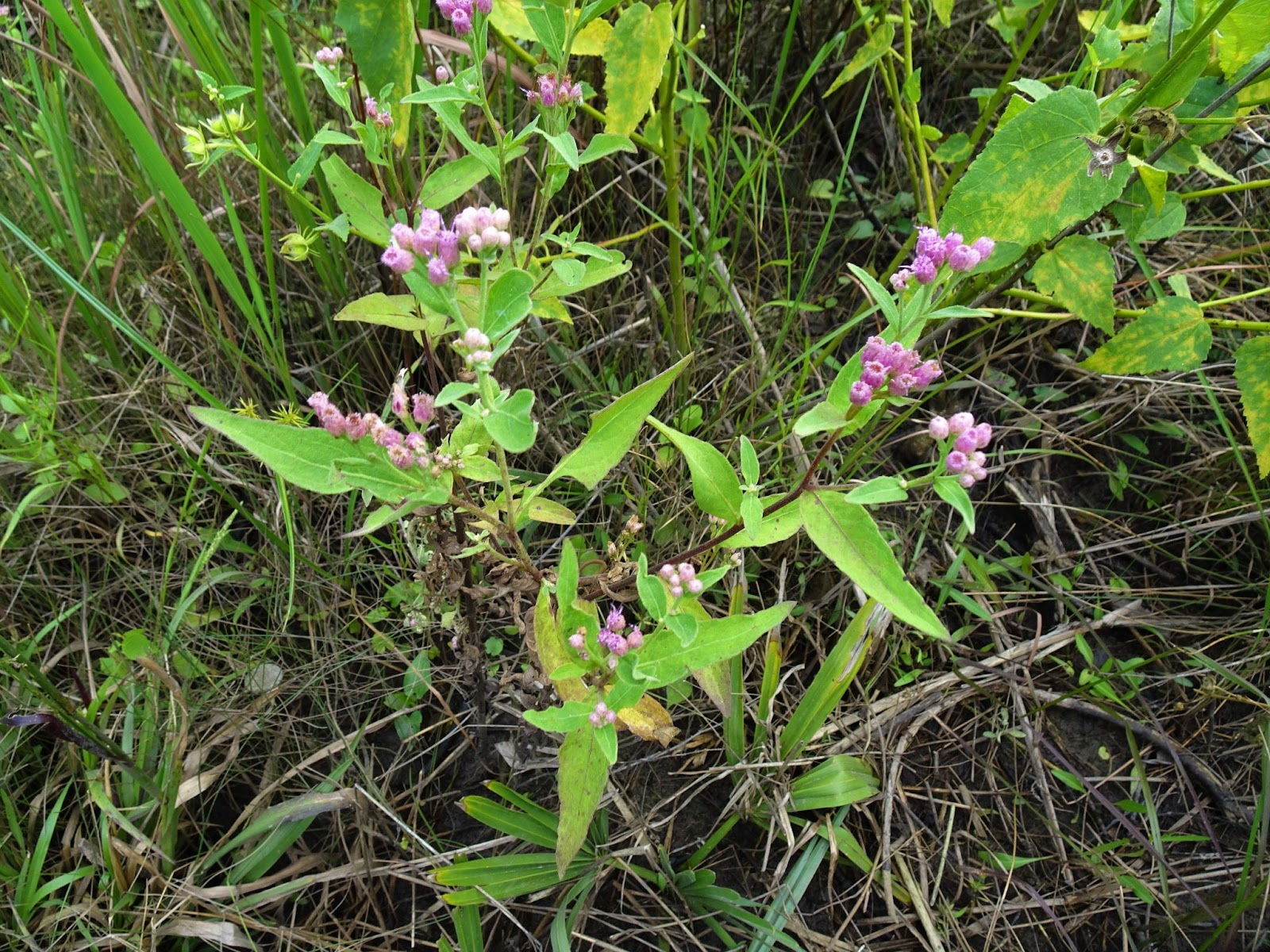
Also growing in this wetland zone are numerous wildflowers, including some common species pictured below.
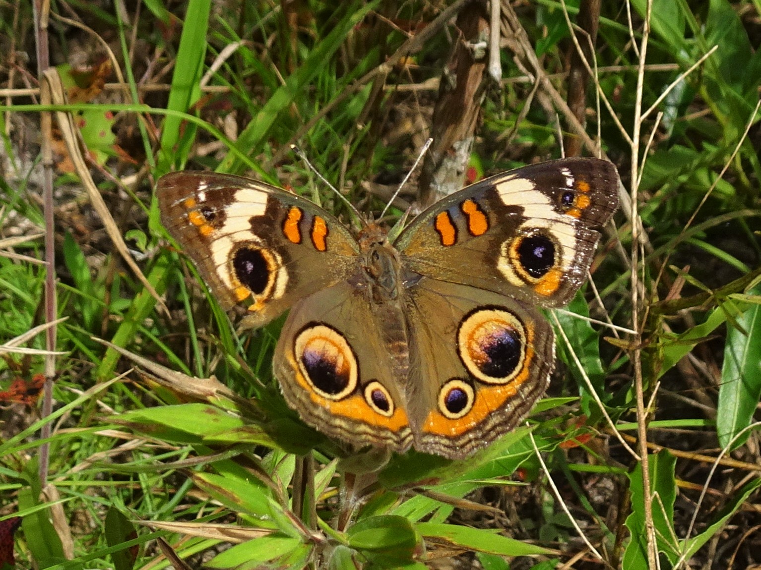
Several butterflies were also out and about, including a Buckeye at rest near the ground, along with camera-shy bright yellow Sulphur and bold orange Gulf Coast Fritillary butterflies.
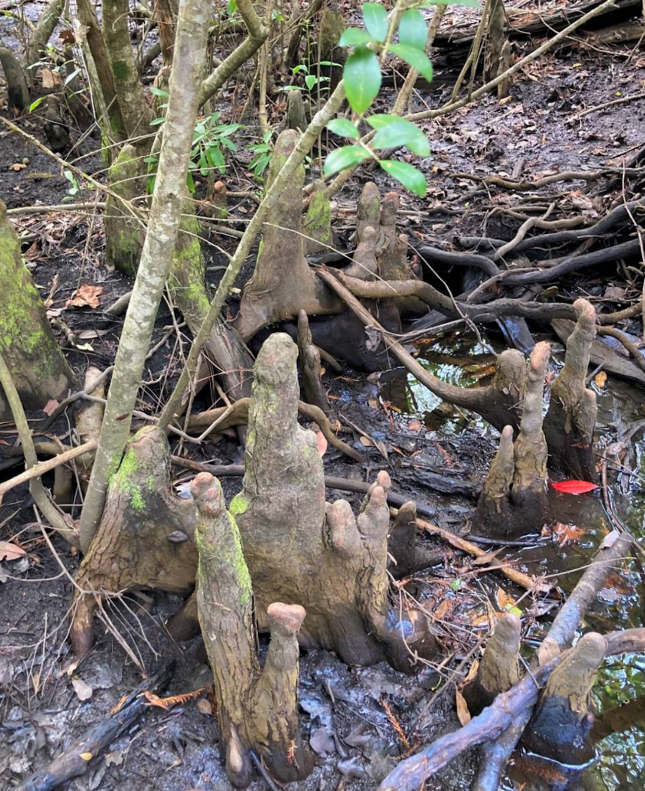
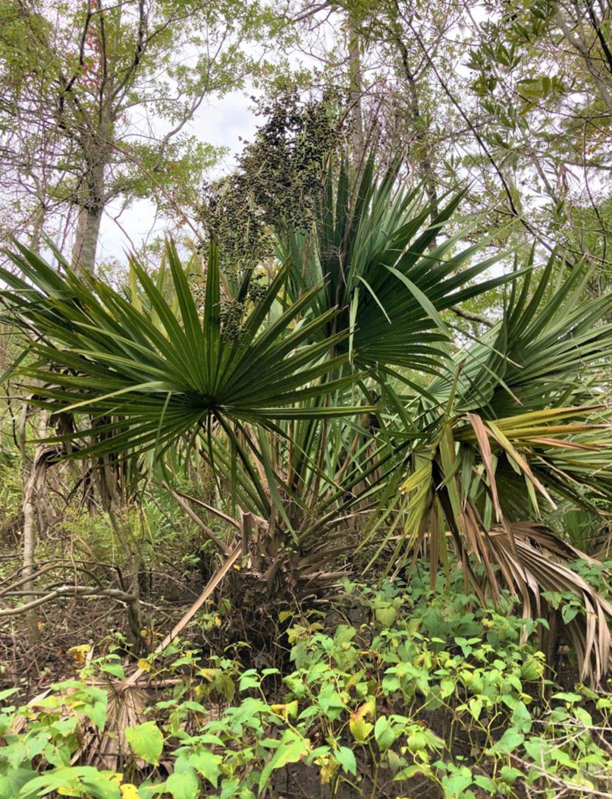
After following the marsh-scrub forest edge I entered a small area of fringing forest supporting Loblolly Pine (Pinus taeda) and baldcypress (Taxodium distichum). Some of the pines have trunks 24-30 inches in diameter though they are only about 50 to 75 feet tall, owing to their 100-plus years of exposure to wind and salt spray. The baldcypress growing among the pines are slower-growing and, while smaller-statured, some of the cypress may be twice the age of the pines.
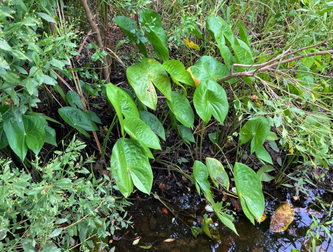
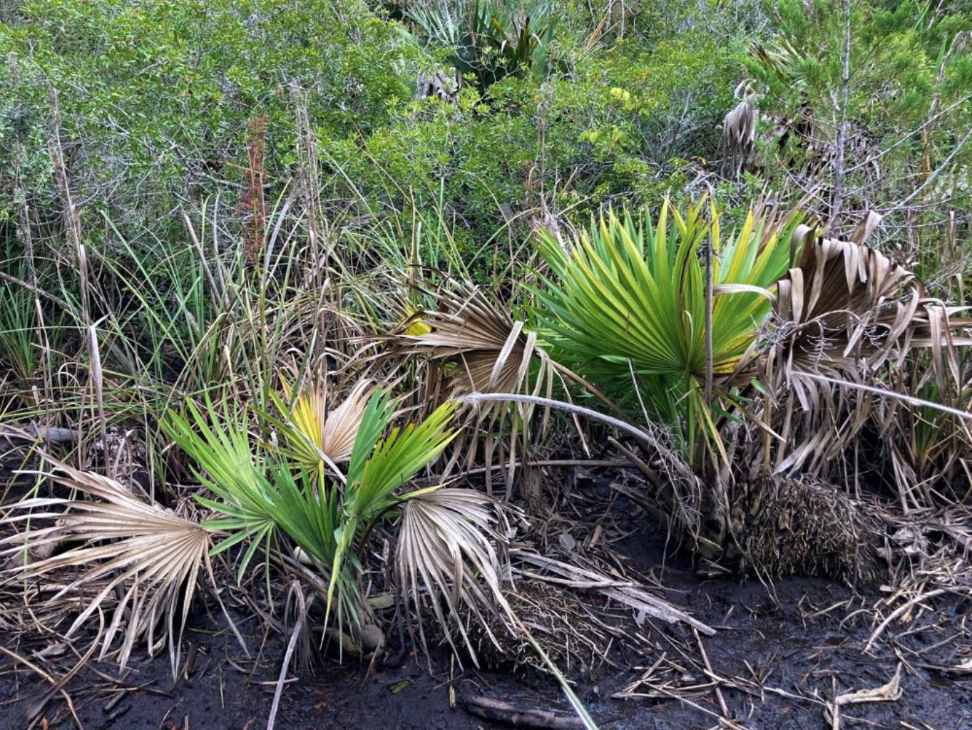
But conifer trees were not my primary point of interest. I was there to check on a population of old-growth Dwarf Palmetto (Sabal minor), the descendant population of palms that have been living in the Howe Creek swamp forest for thousands of years—long before the Intracoastal Waterway was dug. They are the last of a long line of palms and, though safe from being paved over by concrete, their future will be measured by the rate of ocean expansion.
In this place, the palmetto, pine, and baldcypress are sentinels telling us our coastal zone is shifting inland.
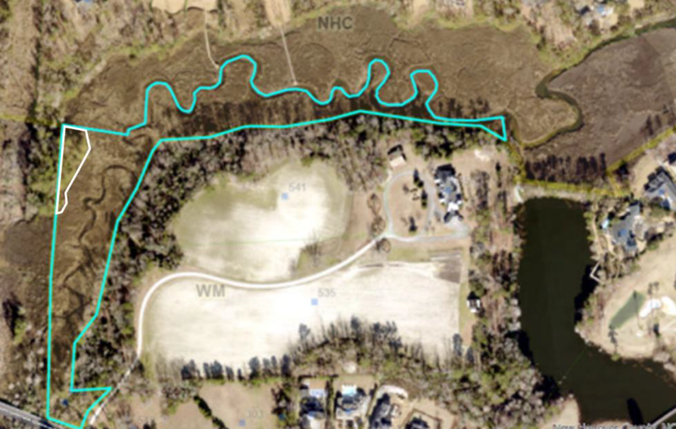
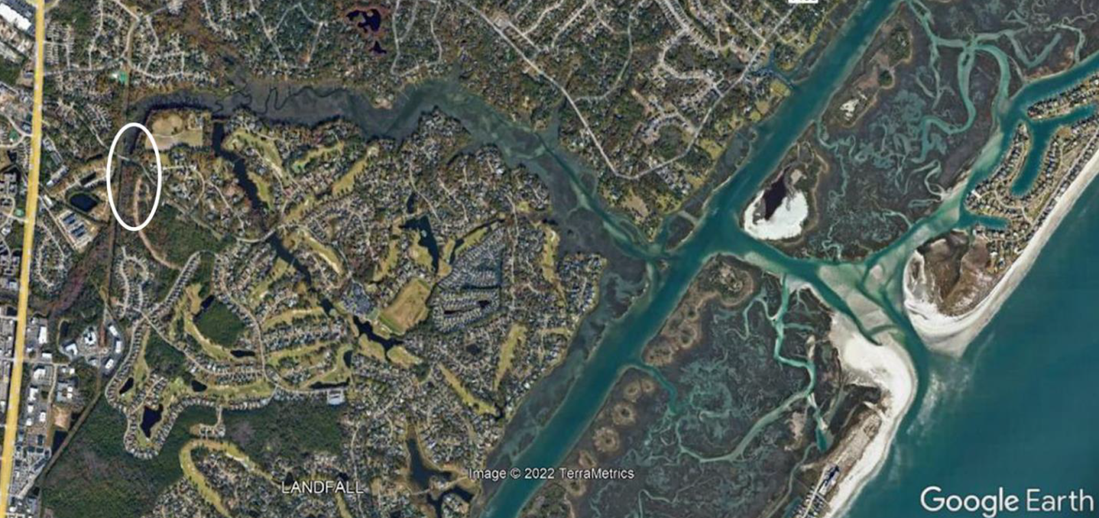
I’ll admit this is a bittersweet article. The imperiled forest, highlighted within the white oval above, extends further upstream from there (southeastward). While this forest is doomed to become marsh, that would inevitably happen regardless of the ICW and human-accelerated climate change. Not long ago, this small patch of forest extended out to the saltmarsh behind Wrightsville Beach and Figure Eight Island. The stumps of long-ago cut cypress can still be found along Howe Creek’s channel all the way to the ICW. Isolated tree stumps can also be found dotting the marshes where tidal creeks meander through former swamp soil.
Taken in that view, I find it even more heartening that this little parcel of forest persists today, respectfully protected in perpetuity by the Northeast New Hanover Conservancy. To be blunt, which I must be, it’s too late to save this small forest from transitioning into saltmarsh. It may take a couple decades or less to get there, but that’s where this habitat is heading. And this reality makes it more important to do whatever we can to protect Howe Creek’s remaining upstream natural habitat.
The Conservancy obviously can’t control what a landowner wants to do with their property but we can control what happens in Conservancy property, which includes more than 200 acres of Howe Creek’s watershed, west of the ICW. We also manage an 88-acre area of saltmarsh behind Shell Island, where Howe Creek’s freshwater mixes with salty ocean water. Our on-the-ground work includes conducting essential monitoring before implementing management practices that we employ to prevent natural habitats from languishing into decline. And to be clear, the Conservancy’s properties make up a significant percentage of New Hanover County’s last best parcels of natural habitat. There’s no hyperbole in that statement, especially considering the county has already lost more than 80 percent of its former natural makeup.
The 2,000 acres of natural forests and saltmarshes under the Conservancy’s care are providing ecosystem services to the benefit of all people. These habitats filter air and water, they reduce localized flooding, and forests and marshes capture carbon dioxide and store it as carbon in plant tissue and organic-rich soil. These are life support services that nature provides for free, that our modern human technologies cannot replicate, for free or otherwise. In a real sense, the Conservancy provides a public service to everyone. While others talk about coastal resilience and climate adaptation planning, or wring their hands in dismay, the Conservancy is working with nature to make things better for people, plants, and wildlife.
We are shepherds of this ecoregion’s natural heritage and we need your help to keep alight the flame of passion for the environment that sustains us. Education is our conservation strategy to fire-up tomorrow’s conservationists, but we really need financial help to manage the wild places that future conservationists will inherit.
To paraphrase an old cliché, “Goodly habitat isn’t cheap, and cheapened habitat isn’t good.” The Conservancy is protecting this ecoregion’s last best parcels of natural habitat and we need your financial support to ensure a place for old palms especially in the face of a changing coastal realm.
Thank you for your consideration of this request and we look forward to hearing from you, especially if you have questions about our areas of interest and work to protect them.